Geosys Regional Monitoring Data Catalogue🔗
What's included in the weather chain🔗
FORECAST WEATHER MODELS
- ENS model (ECMWF*, probabilistic, 20km resolution, forecast D+14)
- GFS model (NOAA-NCEP**, determinist, 25km resolution, forecast D+14)
HISTORICAL DATA
- Historical data depth from 1990 to 2019 (today less 15 days)
SLIDING REPROCESSING D - 3 MONTHS, THEN D - 15 DAYS
- ERA-5*** (ECMWF) historical data integrated every beginning of the month with Current Month minus 3 months data (on the 31st of July, the 30th of April data is the last available data = 3 months)
- ERA-5T*** (ECMWF) historical data integrated day by day at D-15 days.
- ENS (ECMWF) D0 values (pseudo-analysis) stored from D0 to last ERA-5T historical available data ( D-15 days )
Data source references
- *European Center for Weather Forecasts (ECMWF), based in Reading, UK.
- **National Oceanic and Atmospheric Administration - National Center for Environmental Prediction (USA).
- ***The data assimilation system
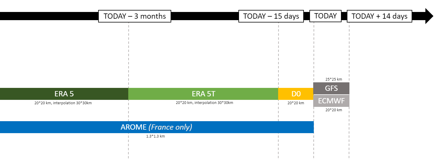 Figure 1 - Link between providers, time of delivery and reprocessing of the data
Parameters, related maps and graphs🔗
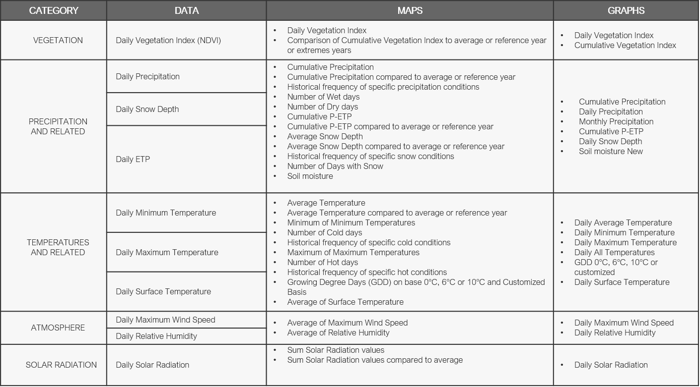 Figure 2 - Different data parameters and corresponding maps and curves
Data technical description🔗
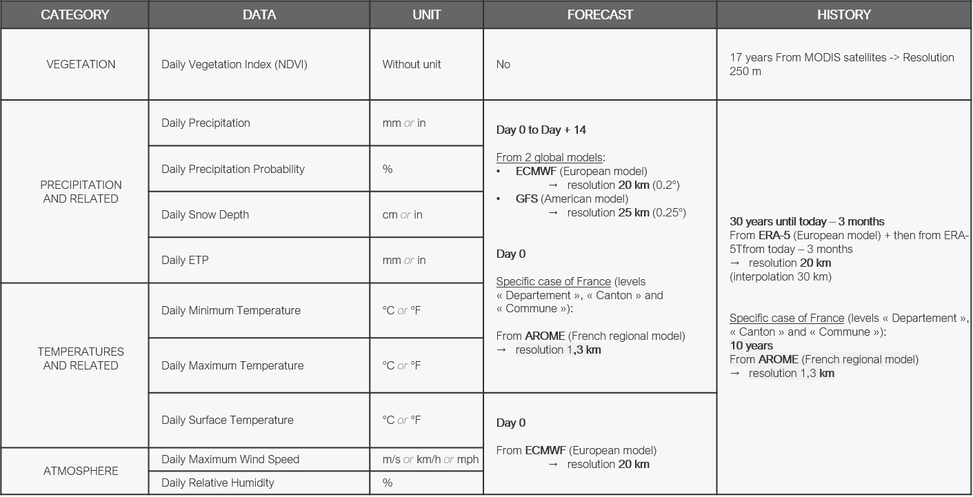 Figure 3 - List of data types and their units (1)
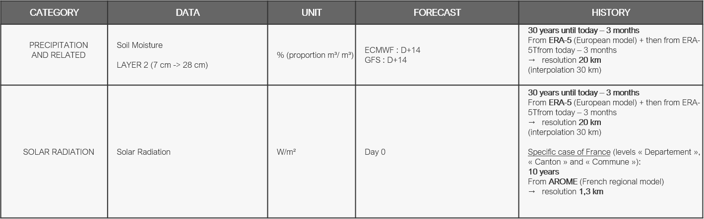 Figure 4 - List of data types and their units (2)
Available levels of aggregation🔗
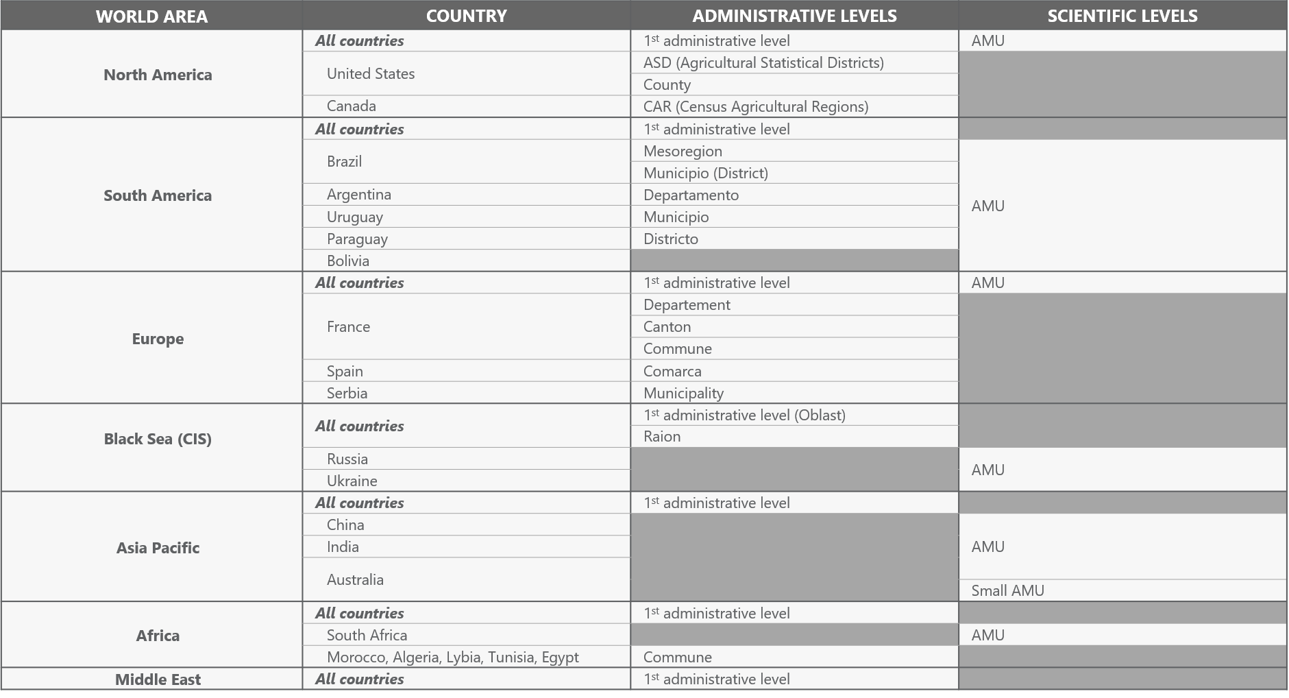 Figure 5 - Available regions and level of aggregation
Ready to learn more? Our team is available to discuss how EarthDaily's agricultural intelligence platform can meet your specific needs.
Contact us